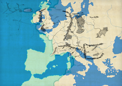
The basis for this exercise was Tolkien's statement in Letter 294, recently confirmed by the draft for the Pauline Baynes map, that Hobbiton was located at the latitude (and, implicitly, the longitude) of Oxford. An earlier, more tentative version of this map I had produced many years ago, but now I was delighted to find that my computations from back then have been confirmed by Tolkien's notes on the Baynes draft!
The present map also helped to identify the latitude of Erebor. Entering this value into the free astronomy software "Stellarium" then allowed me to run a set of simulations that showed the positions of the sun and moon in the sky at Durin's Day and, from there, to establish the entire lunar almanac of "The Hobbit". The results of this simulation are part of my other book, "The Moon in 'The Hobbit'" (see the links at the bottom of this page).


Keine Kommentare:
Kommentar veröffentlichen